 Here are the details of maps for Knighton:

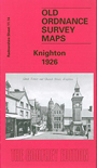
This detailed map covers the small Radnorshire town of Knighton, with coverage extending southward to Great Frydd Wood and westward to Whitterleys Cottage and Racecourse Farm. The map also includes Shropshire sheet 76.14 (Knighton station is actually in Shropshire).
Features include town centre with individual buildings neatly delineated, Central Wales railway with most of station (at eastern edge of map), castle site, St Edward's church, Railway Hotel, Teme Bridge, Clock Tower, Mill Green area, Jackets Bridge, Market Street, Broad Street, River Teme, schools, Garth, Upper Mill, Wilcome Brook, cattle pens, Brookhouse Farm etc. On the reverse we include a 1906 directory of Knighton.