Old Ordnance Survey Maps of Perthshire

  • These detailed maps normally cover an area of about one and a half miles by one mile. Each map includes an introduction.
  • They are available through our On-line Mapshop

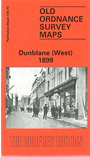
  • Here are the details of maps for Dunblane (West):

  • Perthshire Sheet 125.15 Dunblane (West) 1899 - published 1989; intro by Alastair MacLaren. ISBN.978-0-85054-265-3

    This detailed map is double-sided for maximum coverage. The main map covers the western part of the town, with coverage running from the Cathedral westward to Corsecaplie and northward to Laigh Hill. Features include stretches of railway including the Callander branch, Cathedral, Springbank Carding Mill, Doune Road area, Court House, Jail, railway station (at foot of map).

    On the reverse we include half of adjacent sheet 132.03 extending coverage southward to include rest of railway station, RC church, Hungryhill Wood, Keir Mains, Wanderwrang Strip, Biggins Wood.

    The map links up with sheet 125.16 Dunblane (East) to the east.


  • Follow this link for a complete list of our Perthshire maps.
  • You can order maps direct from our On-line Mapshop. For other information and prices, and other areas, go to The Index Page
  • Maps in the Godfrey Edition are taken from the 25 inch to the mile map and reduced to about 15 inches to the mile. For a full list of maps for Scotland, return to the Scotland page.
    The Godfrey Edition / sales@alangodfreymaps.co.uk / 5 November 2016