
Here are the details of maps for Kirkwall:
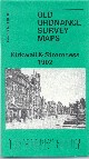 Orkney Sheet 108.03 Kirkwall & Stromness 1902 - published 1988; intro by W S Hewison. ISBN.978-0-85054-291-2
This detailed map is double-sided for maximum coverage.The main map covers Kirkwall itself, showing most of the small town in detail with individual buildings neatly delineated. Features include harbour, St Magnus Cathedral, Peerie Sea, County Buildings, Easthill Quarries, Combination Poorhouse, Crafty, Papdale, palace ruins etc.
On the reverse we include a similarly detailed map of Stromness, where features include Stromness Harbour, Outer Holm, Inner Holm, Whitehouse Rocks, The Ness, Fish Curing Station, Town Hall, piers, Dundas Street, Victoria Street and the many small buildings clustered along the waterfront.