
 Here is information about Sheet 341 & 342:
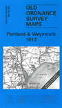
This Inch to the Mile title includes two maps. The main map is sheet 342, which covers Portland, Weymouth, and the Dorset coast eastward to Tyneham and Kimmeridge. Sheet 341, which covers part of the Chesil Bank and the area around Langton Herring, is included as an inset. On the reverse we include a map of Lulworth Cove.
It is not possible to list the many hamlets, farmsteads and other topographical features shown on these maps. However, you may find it useful if we list the towns and principal villages or church parishes that are included on this map. Links are given for those for which detailed large-scale maps are also available.
Index maps are available showing the areas covered by the Inch to the Mile maps. Go to This page
You can order maps direct from our On-line Mapshop. For a full list of Inch to the Mile maps go to the Inch to the Mile page, where you will also find details of prices. For information on the rest of the series, go to The Index Page.