
 Here is information about Sheet 322:
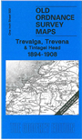
Two maps for the price of one! With this map we print two versions of sheet 322 side by side, the revisions of 1894 and 1908. This means that you can easily compare the differences between the two, and in his introduction Dr Richard Oliver discusses some of the Ordnance Survey specifications across this period. Although there may seem to have been little development in this area, in fact the map produces dozens of tiny changes, to produce almost a 'spot the difference' competition.
The map covers the west Cornwall area around Boscastle and Tintagel, with coverage inland to Jacobstow. On the reverse we include a detailed map of the tiny village of Trevalga.
It is not possible to list the many hamlets, farmsteads and other topographical features shown on these maps. However, you may find it useful if we list the towns and principal villages or church parishes that are included on this map. Links are given for those for which detailed large-scale maps are also available.
Index maps are available showing the areas covered by the Inch to the Mile maps. Go to This page
You can order maps direct from our On-line Mapshop. For a full list of Inch to the Mile maps go to the Inch to the Mile page, where you will also find details of prices. For information on the rest of the series, go to The Index Page.