
 Here is information about Sheet 293:
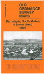
This Inch to the Mile map covers the area around and to the east of Barnstaple, including the western part of Exmoor, around Simonsbath. On the reverse we include a detailed map of the small town of South Molton, showing all buildings on and around the town centre, including Broad Street, East Street, South Street, Mill Streetr and Barnstaple Street.
It is not possible to list the many hamlets, farmsteads and other topographical features shown on these maps. However, you may find it useful if we list the towns and principal villages or church parishes that are included on this map. Links are given for those for which detailed large-scale maps are also available.
For a full list of Inch to the Mile maps go to the One Inch Page; or for larger scale maps of the South West go to the South West page.
You can order maps direct from our On-line Mapshop. For other information and prices, and other areas, go to The Index Page.