Old Ordnance Survey Maps of County Offaly


  • These highly detailed maps normally cover an area of about one and a half miles by one mile. Each map includes an introduction.
  • They are available through our On-line Mapshop.

  • Here are the details of maps for Clara:

  • Co Offaly Sheet 8.06 Clara & Ferbane 1910 - published 2011; introduction by Michael Goodbody. ISBN.978-1-84784-457-6

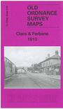
    This very detailed map is double-sided for maximum coverage. The main map goives good coverage of Clara, covering the town centre and extending westward to the Clashawaun Works and eastward to Kilcoursey House. Principal features include railway with both stations, engine shed, Charlestown area, St Brigid's Convent, Clara House, Castle Hill, Inchmore, Fair Green, St Brigid's church, Clashawaun jute works, Flour Mill etc.

    On the reverse we include part of sheet 14.12 covering the small town of Ferbane, with coverage extending from the Main Street southward to Gallen Priory. Features include station, Convent, St Mary's RC church.


  • Follow this link for a complete list of our Co Offaly Series maps.
  • You can order maps direct from our On-line Mapshop. For other information and prices, and other areas, go to The Index Page.
  • Maps in the Godfrey Edition are taken from the 25 inch to the mile map and reduced to about 15 inches to the mile. For a full list of maps for Ireland, return to the Ireland page.
    The Godfrey Edition / sales@alangodfreymaps.co.uk / 16 January 2018