Old Ordnance Survey Maps of Northumberland

  • These detailed maps normally cover an area of about one and a half miles by one mile. Each map includes an introduction.
  • They are available through our On-line Mapshop

  • Here are the details of maps for Ponteland:

  • Northumberland Sheet 85.05 Ponteland 1913 - published 2025; introduction by Alan Godfrey. ISBN.978-1-78721-913-7

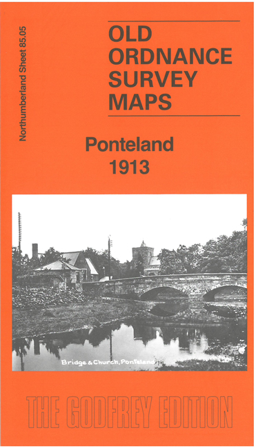
    This detailed map gives good coverage of Ponteland and extends eastward to Prestwick.

    Features include River Pont, Ponteland village, railway with Ponteland station and part of branch to Darras Hall, St Mary's church, Castle Ward Union Workhouse, Bell Villas, Eland Green, Black Bird pub, Ponteland Castle remains, Prestwick Lodge, Eland Hall, etc

    We also include an extract from the 1895 map, together with a specially written introduction to the history of the area.


  • Follow this link for a complete list of our Northumberland maps. For other information and prices, and other areas, go to The Index Page.
  • Maps in the Godfrey Edition are taken from the 25 inch to the mile map and reduced to about 15 inches to the mile. For a full list of maps for the North East, return to the North East page.
    The Godfrey Edition / sales@alangodfreymaps.co.uk / 6 November 2025