l>
Old Maps of Broomhouse, Glasgow
Old Ordnance Survey Maps of Lanarkshire
These detailed maps normally cover an area of about one and a half miles by one mile. Each map includes an introduction.
They are available through our On-line Mapshop
 Here are the details of maps for Broomhouse:
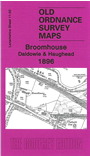
Lanarkshire Sheet 11.02 Broomhouse, Daldowie & Haughead 1896 - published 2010; intro by Gilbert Bell. ISBN.978-1-84784-367-8 
This detailed map covers the area from Broomhouse and Wester Daldowie southward to Newton House and Redlawood.
Features include Maryville, Haughead Colliery, East and West Haughead, Clydeside Coal Pit, Kenmuirhill Colliery Pit 2 and Newton Pit No.4; River Clyde. A Cumbuslang directory entries A-D is included on the reverse.
The map links up with Lanarkshire sheets 11.01 Carmyle to the west, 11.03 Tannochside to the east and 11.06 Drumsagard to the south.
Follow this link for a complete list of our Glasgow or Lanarkshire maps.
You can order maps direct from our On-line Mapshop.
For other information and prices, and other areas, go to The Index Page.
Maps in the Godfrey Edition are taken from the 25 inch to the mile map and reduced to about 15 inches to the mile.
For a full list of maps for Scotland, return to the Scotland page.
The Godfrey Edition / sales@alangodfreymaps.co.uk / 11 November 2016