Old Ordnance Survey Maps of Linlithgowshire

  • These detailed maps normally cover an area of about one and a half miles by one mile. Each map includes an introduction.
  • They are available through our On-line Mapshop

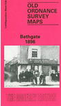
  • Here are the details of maps for Bathgate:

  • Linlithgowshire Sheet 9.06 Bathgate 1896 - published 1992; intro by William F Hendrie. ISBN.978-0-85054-553-1

    This detailed map is double-sided for maximum coverage. The main map covers most of the town, with coverage extending SE to Kirkroads. Features include town centre with individual buildings neatly shown, churches, NBR Bathgate Section with Upper Station, Polkenmet Junction, Lower Station, mineral railway, Balbardie Collieries Mine, Bridge-end, Easton, disused colliery, Iron Foundry, West Lothian Shovel Works, Bathgate Academy, Balbardie House etc.

    On the reverse we include about half of adjacent sheet 9.02 extending coverage northward to include Balbardie Mains, Glenmavis Distillery, Balbardie Pit No.1, Ballencrieff Mains.


  • Follow this link for a complete list of our Linlithgowshire maps.
  • You can order maps direct from our On-line Mapshop. For other information and prices, and other areas, go to The Index Page.
  • Maps in the Godfrey Edition are taken from the 25 inch to the mile map and reduced to about 15 inches to the mile. For a full list of maps for Scotland, return to the Scotland page.
    The Godfrey Edition / sales@alangodfreymaps.co.uk / 5 Nov 2016