
 Here are the details of maps for Spalding:

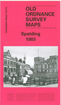
This detailed map covers most of the Fenland town of Spalding, and is double-sided for maximum coverage. The main map covers the northern half of the town, with coverage extending from Station Street and Hall Place northward to Marsh Road, and from the station eastward to Holbeck Road and St Paul's church Fulney. Features include the River Welland, windmill, Exeter Drain, New Road, Workhouse, cemetery, Westlode Street, Pinchbeck Street, Manor House. On the reverse is a large section of adjacent sheet 140.02 extending coverage south to include St Mary & St Nicholas church, Ayscoughfee Hall, Clay Lake, Holyrood House, London Road, Locks Mill Farm, Market Place, The Crescent, railway junctions, brewery, Welland Hall, St Peter's church.