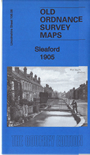
Lincolnshire Sheet 106.06 Sleaford 1905 - published 2016; introduction by Tony Kirby. ISBN.978-1-84784-990-8 
This detailed map of Sleaford is double-sided for maximum coverage. It covers most of the town.
Features include St Deny's church, Town Hall, the town centre with individual buildings neatly shown, Manor House, Castle Field, River Slea, Clay Hill,
GNR Grantham Sleaford & Boston railway, station, GN & GE Joint Railway, Galley Hill, Carre's Grammar School, New Quarrington,
Quarrington Hill, Thornhayes, Bristol Arms Farm, Malthouses, Old Place, The Pines, Sleaford Union Workhouse, Coggleford Mill, etc.
Follow this link for a complete list of our Lincolnshire Series maps.
You can order maps direct from our On-line Mapshop.
For other information and prices, and other areas, go to The Index Page.
Maps in the Godfrey Edition are taken from the 25 inch to the mile map and reduced to about 15 inches to the mile.
For a full list of maps for England, return to the England page.
Alan Godfrey Maps, Prospect Business Park, Leadgate, Consett, Co Durham, DH8 7PW / sales@alangodfreymaps.co.uk / 25 November 2016
 Here are the details of maps for Sleaford: