Old Ordnance Survey Maps of Stockport MBC

  • These detailed maps normally cover an area of about one and a half miles by one mile. Each map includes an introduction.
  • They are available through our On-line Mapshop

  • Here are the details of maps for Stockport Edgeley:

  • Lancs 111.16a Stockport (Edgeley & Cheadle Heath) 1916 - published 2019; intro by Chris Makepeace. ISBN.978-1-78721-232-9
  • Lancs 111.16b Stockport (Edgeley & Cheadle Heath) 1934 - published 2019; intro by Alan Godfrey. ISBN.978-1-78721-249-7

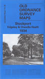
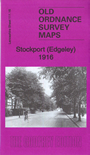
    We have published two versions of this map, showing how the area changed across the years. Each covers the area to the west of Stockport, with coverage of Edgeley and Cheadle Heath.

    Features include River Mersey, Howard's Buildings, Alexandra Park, Edgeley Bleach Works, Edgeley Road and Castle Street area, Brinksway Mill, cotton mills, tramways, Sovereign Iron Works, part of Edgeley engine shed, several railway lines, Cheadle Heath station, Heaton Mersey engine shed, Heath Bank, St Matthew's church, Brinksway Bank Mill, Stockport County football ground, etc

    The map links up with Lancashire Sheets 111.12 Heaton Norris to the north, 111.15 Cheadle North to the west, 112.13 Stockport South to the east.

    Further maps of Stockport are available in our Cheshire series.


  • Follow this link for a complete list of our Stockport or Manchester maps.
  • You can order maps direct from our On-line Mapshop. For other information and prices, and other areas, go to The Index Page.
  • Maps in the Godfrey Edition are taken from the 25 inch to the mile map and reduced to about 15 inches to the mile. For a full list of maps for the North West, return to the North West page.
    The Godfrey Edition / sales@alangodfreymaps.co.uk / 22 June 2019