
 Here are the details of maps for Carrington:

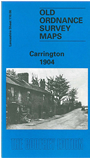
This detailed map covers an area west of Manchester on the River Mersey and although it is a Lancashire sheet, most coverage is of the Cheshire side of the river. The main feature is the Cheshire village of Carrington, incl Windmill Inn, Carrington Hall Farm, Holly Farm, Stamford Farm and Dainewell Farm. Further west are Boothhey Farm, St George's church and (bottom left corner of map) Landfield Farm. A section of the Manchester Ship Canal is in the top left corner, incl Carrington Wharf, with a tramway running across the map carrying sewage. What at first seems a rather empty map is filled with interest, and Don Bayliss gives a full historical background.
The map links up with sheet 110.02 Flixton to the north and 110.05 Lower Irlam to the west.