Old Ordnance Survey Maps of Lancashire

  • These detailed maps normally cover an area of about one and a half miles by one mile. Each map includes an introduction.
  • They are available through our On-line Mapshop

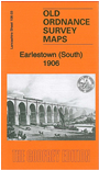
  • Here are the details of maps for Earlestown (S):

  • Lancs Sheet 108.03a Earlestown (South) 1891 - published 2010; intro by Kay Parrott. ISBN.978-1-84784-417-0
  • Lancs Sheet 108.03b Earlestown (South) 1906 - published 2013; intro by Alan Godfrey. ISBN.978-1-84784-659-4

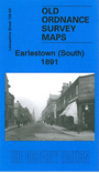
    We have published two versions of this map, showimng how the area changed across the years. Each covers the southern part of Earlestown with coverage extending westward to Collins Green.

    Features include Viaduct wagon works, St Helens Canal, Sankey Sugar Works, Vitrioal Square, Collins Green, Collins Green Colliery, LNWR railway with Collins Green station, part of Earlestown station, Sankey Viaduct, Penkford Bridge, Bradley Hall, Haydock Crossing, Earle Street area, King Street area, Newton Common etc. On the reverse we include Liverpool-Earlestown-Manchester railway timetables for 1897.

    The map links up sheet 101.15 Earlestown North to the north, 108.04 Newton (South) to the east.


  • Follow this link for a complete list of our St Helens or Liverpool maps.
  • You can order maps direct from our On-line Mapshop. For other information and prices, and other areas, go to The Index Page.
  • Maps in the Godfrey Edition are taken from the 25 inch to the mile map and reduced to about 15 inches to the mile. For a full list of maps for the North West, return to the North West page.
    The Godfrey Edition / sales@alangodfreymaps.co.uk / 27 May 2018