
 Here are the details of maps for Rainsough:

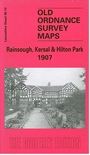
This detailed map covers the Rainsough and Hilton Park areas of Prestwich; further south is part of the Kersal area of Salford. Features include Kersal Hall, Kersal Vale Works, Kersal Moor, Myrtle Grove Bleach Works, Hilton House, Hope Square, part of Prestwich Hills Reservoirs, Rainsough Hill, Prestwich Lodge, Irwell House smallpox hospital etc. The River Irwell runs through the map and west of it is a largely rural area, incl part of Northern Cemetery, Hall Hill, Agecroft Grange, Agecroft Hall, a stretch of the Manchester Bolton & Bury Canal. We include a selection of trade directory entries on the reverse, plus street entries for Bury New Road, George Street and Hilton Lane.
The map links up with Lancashire Sheets 96.09 Prestwich to the north, 95.16 Pendlebury to the west, 96.14 Broughton Park to the east and 104.01 Pendleton North to the south.