 Here are the details of maps for Great Lever:

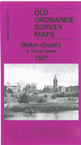
This detailed map covers the southern part of Bolton and much of Great Lever, an independent township until 1898. Coverage stretches from Heywood Recreation Ground southward to Townley's Hospital, and from Morris Green Lane eastward to Great Lever Park.
Features include stretches of the Bolton & Kenyon and Worsley & Bolton railways, Burnden Junction, Lever Grange, Asia Mill, Bradford Mill, Hartford Mill, Doe Hey Wood, Great Lever Spinning Mill, Ocean Mill, Daubhill area, Sunnyside Mill, Swan Lane Mills, St Paul's Mill, Morris Green, Prince Rupert Farm, Walker Institute, Pike Mill, Woodside Mills, Grecian Mills, St Simon & St Jude's church, Rose Hill Mills, St Bartholomew's church, Wellington New Mills etc. A selection of street directory entries is included on the reverse.
The map links up with Lancashire Sheets 87.13 Bolton to the north, 94.04 Bolton Rumford to the west, 95.02 Moses Gate to the east, 95.05 Plodder Lane to the south.