Old Ordnance Survey Maps of Lancashire

  • These detailed maps normally cover an area of about one and a half miles by one mile. Each map includes an introduction.
  • They are available through our On-line Mapshop

  • Here are the details of maps for Shaw:

  • Lancashire Sheet 89.14 Shaw & Crompton 1907 - published 2014; intro by Alan Godfrey. ISBN.978-1-84784-770-6

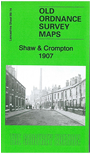
    This detailed map covers the centre of Shaw, with coverage extending westward to include Cowlishaw, Low Crompton and the NE tip of Royton.

    Features include Shaw & Crompton station, tramways, Duke Mill, Dawn Mill, Cape Mill, New Town area, Fern Mill, Shaw Side, Oak Mills, Victoria Mill, Diamond Rope Works, Sandy Lane Mill, Lyon Mill, High Crompton Mills, Park Mill, Fir Mill, Holy Trinity church, St James's church, Entron House, High Crompton House, Low Crompton Colliery, Narrow Gate Brow (in top left corner) etc. We include a 1918 directory on the reverse.

    The map links up with sheets 97.02 Royton to the south.


  • Follow this link for a complete list of our Oldham maps.
  • You can order maps direct from our On-line Mapshop. For other information and prices, and other areas, go to The Index Page.
  • Maps in the Godfrey Edition are taken from the 25 inch to the mile map and reduced to about 15 inches to the mile. For a full list of maps for the North West, return to the North West page.
    The Godfrey Edition / sales@alangodfreymaps.co.uk / 22 January 2018