Old Ordnance Survey Maps of Bury and Rochdale

  • These detailed maps normally cover an area of about one and a half miles by one mile. Each map includes an introduction.
  • They are available through our On-line Mapshop

  • Here are the details of maps for Heywood (North):

  • Lancashire Sheet 88.07 Heywood (North) & Hooley Bridge 1908 - published 2007; intro by Paul Hindle. ISBN.978-1-84784-067-7

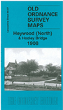
    This detailed map covers the northern part of Heywood, including Heywood Hall, Queen's Park and Hooley Brow. It then extends northward to Kenyon Fold, and westward to Gristlehurst Woof. Other areas on the map include Hooley Bridge, Back o'th' Moss, Simpson Clough, Crimble. Features include the River Roch, Simpson Clough Mill, Plumpton Hall, Bamford Hall, Bamford Woollen Mills (at top of map), Crimble Hall, Gnat Bank. A commercial directory of heywood in 1918 is included on the reverse.

    The map links up with Lancashire Sheets 88.11 Heywood to the south, 88.08 Rochdale SW to the east.


  • Follow this link for a complete list of our Rochdale or Bury maps.
  • You can order maps direct from our On-line Mapshop. For other information and prices, and other areas, go to The Index Page.
  • Maps in the Godfrey Edition are taken from the 25 inch to the mile map and reduced to about 15 inches to the mile. For a full list of maps for the North West, return to the North West page.
    The Godfrey Edition / sales@alangodfreymaps.co.uk / 1 February 2018