Old Ordnance Survey Maps of Bolton MBC

  • These detailed maps normally cover an area of about one and a half miles by one mile. Each map includes an introduction.
  • They are available through our On-line Mapshop

  • Here are the details of maps for Lostock:

  • Lancashire Sheet 86.15 Lostock Junction 1907 - published 2013; intro by Derrick Pratt. ISBN.978-1-84784-675-4

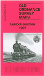
    This detailed map covers the area from Lostock Junction westward to Lostock Hall.

    Features include railways with Lostock Junction station, Industrial School, St Thomas School, Lostock Junction Mills, Lower House, Chorley New Road with tramway, Bessy Brook House, Hollinhurst, numerous detached houses, Bee Hive Mills, Lostock Hall Fold, Pendlebury's Fold etc. A 1914 timetable for the Manchester-Wigan service is included on the reverse.

    The map links up with sheet 86.14 Hilton House to the west, 86.16 Bolton West to the east, 94.03 Wingates to the south.


    Follow this link for a complete list of our Bolton maps.
  • You can order maps direct from our On-line Mapshop. For other information and prices, and other areas, go to The Index Page.
  • Maps in the Godfrey Edition are taken from the 25 inch to the mile map and reduced to about 15 inches to the mile. For a full list of maps for the North West, return to the North West page.
    The Godfrey Edition / sales@alangodfreymaps.co.uk / 1 February 2018