
 Here are the details of maps for Rishton:

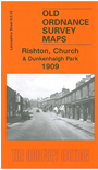
This detailed map is centred on Dunkenhalgh Park. Most of Rishton is in the NW corner and the map extends southward to the Church Works and eastward to Dill Hall.
Features include Dunkenhalgh Hall, two stretches of the Leeds & Liverpool Canal plus the Peel Arm, Rishton Colliery, Rishton Mill, Wheatfield Mill, Daisyhill Mill, Rishton town centre as far west as Walmsley Street, Henfield House, Prospect Mill, Atlas Works, part of Enfield area, Whin Isle Farm, Accrington & Church Sewage Works, Dill Hall area, Churchbank Mill, St James church, Church Kirk Bridge, Church Works, Peel Bank, Church Hall, Elmfield Hall, Coppy Clough Chemical Works (in ruins) etc. On the reverse we include a 1918 directory of Church.
The map links up with Lancashire sheets 63.09 Rishton West to the west, 63.14 Oswaldtwistle to the south.