
 Here are the details of maps for Lancaster:

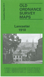
This detailed map covers the centre and northern part of Lancaster. Coverage stretches from Marton Street and Queen Square northward to Broadway, Skerton, and from Derwent Road westward to Willow Lane. Major features include Castle station, Market Hall, Town Hall, tramways, St Mary's church, town centre shown in detail, St Peter's RC church, Greenfield Mills, Moor Lane Mills, Bath Mill, Giant Axe Field, Green Ayre station, St Luke's church Skerton, Workhouse, Lune Villa, Midland Railway Castle Branch with engine shed, Glasson Dock Branch, LNWR Lancaster Quay Branch, Ryelands and much more. On the reverse are extracts from a contemporary trade directory.
The map links up with Lancashire Sheet 30.15 Lancaster South to the south.