
Here are the details of maps for Morecambe
Lancashire Sheet 30.05a · Morecambe 1911
Published 1992; intro by Lynn Wilman.
ISBN 978-0-85054-546-3

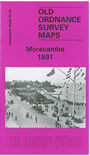
Lancashire Sheet 30.05b · Morecambe 1931
Published 2007; intro by Alan Godfrey.
ISBN 978-1-84784-084-4
We have published two maps of Morecambe, showing how the town developed over the years. Note however that the 1931 version covers a slightly larger area.
The principal map covers the centre of the town and West End, with coverage stretching from Queen's Terrace and Green Street southward to Fairfield Road. Features include most of the harbour, Midland station, Euston Road station, Torrisholme Junction No.2, Poulton Hall, Winter Gardens, Poulton Square, Midland Hotel, tramway and depot (1911 map), Promenade, West End, West End Pier, Sandylands, Wood Hill.
The 1911 version has extracts from a contemporary trade directory on the reverse. However, on the reverse of the 1931 version we include adjacent Sheet 30.01, which extends coverage northward to include the Central Pier, Tower Theatre and Town Hall. If you are only buying one version we therefore recommend the 1931 one.