Old Ordnance Survey Maps of Lancashire

  • These detailed maps normally cover an area of about one and a half miles by one mile. Each map includes an introduction.
  • They are available through our On-line Mapshop

  • Here are the details of maps for Barrow (South):

  • Lancashire Sheet 21.15 Barrow in Furness (South) 1911 - published 1991; intro by Ron Smith. ISBN.978-0-85054-490-9

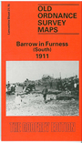
    This detailed map, which covers the southern part of Barrow, is double-sided for maximum coverage. The main map covers the area from the Walney Channel westward to Biggar Bank and Tummer Hill Scar, and includes part of Biggar Sands. Features include Cove Hakes, Water Garth Nook, Ocean Road, Harbour Yard, Ramsden Dock station, Furness Railway Ramsden Dock Branch. On the reverse we include part of adjacent sheet 21.16 extending coverage east to includeTimber Dock, Anchor Basin, Dock Basin, Ramsden Dock and railways around the docks.

    This map links up with Sheets 21.11 Barrow (West) and 21.12 Barrow (East) to the north.


  • Follow this link for a complete list of our Furness area or Cumbrian maps.
  • You can order maps direct from our On-line Mapshop. For other information and prices, and other areas, go to The Index Page.
  • Maps in the Godfrey Edition are taken from the 25 inch to the mile map and reduced to about 15 inches to the mile. For a full list of maps for the North West, return to the North West page.
    The Godfrey Edition / sales@alangodfreymaps.co.uk / 15 January 2018