Old Ordnance Survey Maps of Dumfries & Galloway

  • These detailed maps normally cover an area of about one and a half miles by one mile. Each map includes an introduction.
  • They are available through our On-line Mapshop

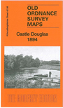
  • Here are the details of maps for Castle Douglas:

  • Kirkcudbrightshire 42.08 Castle Douglas 1894 - published 2013; intro by Pamela Taylor. ISBN.978-1-84784-664-8

    This detailed map is double-sided for maximum coverage and covers most of the town of Castle Douglas in detail.

    The main map covers the centre and west of the town. Features include St Ninian's church, Dunmuir House, other churches, town centre with individual buildings shown, The Common, most of Carlingwark Loch, Ducking Island, railway approaches, King Street area, Kelton Mains, Blackpark, Meikle Wood Hill, Little Wood Hill.

    On the reverse we include part of adjacent sheet 43.05, extending coverage eastward to include railway station, Auction Marts, Market Hill, Whitepark Hill, Black Loch.


  • Follow this link for a complete list of our Dumfries & Galloway maps.
  • You can order maps direct from our On-line Mapshop. For other information and prices, and other areas, go to The Index Page.
  • Maps in the Godfrey Edition are taken from the 25 inch to the mile map and reduced to about 15 inches to the mile. For a full list of maps for Scotland, return to the Scotland page.
    The Godfrey Edition / sales@alangodfreymaps.co.uk / 18 November 2016