Inch to the Mile Maps of Ireland

  • These Old Ordnance Survey Maps normally cover an area of about 18 miles by 12 miles and are especially good at showing railways, roads and canals, and at giving a broad view of a wider area. Each includes an introduction and a more detailed map of a small town or village. They are available through our On-line Mapshop

  • Here is information about Sheet 56:

  • Ireland Sheet 56 Swanlinbar & Cuilcagh Mountain 1899 - published 2000; intro by Alan Godfrey. ISBN.978-1-84151-149-8

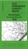
    This Inch to the Mile map covers areas of Counties Cavan, Fermanagh and Leitrim. Coverage stretches from Lough Nilly southward to Lough Allen, and from Killadiskert eastward to Swanlinbar.

    The only substantial settlement on the map is Swanlinbar. Other features include a stretch of the Sligo Leitrim & Northern Counties Railway, Cuilcagh, Dowra, Benbrack, Bencroy, Florence Court, Brackley Lake.

    On the reverse we include a detailed map of Swanlinbar itself, with individual houses neatly delineated, mostly alongside the main (only) street; other features include churches, Trivia House, Constabulary Barracks, Long Bridge, St Mary's Presbytery.


    It is not possible to list the many hamlets, farmsteads and other topographical features shown on these maps. However, you may find it useful if we list the towns and principal villages or church parishes that are included on this map. Links are given for those for which detailed large-scale maps are also available.

  • Co Cavan: Blacklion, Swanlinbar, Termon.
  • Co Fermanagh: Drumcard, Florence Court, Tullyhona, Wheathill
  • Co Leitrim: Drumnafinnila, Glenfarn, Killadiskert
  • An index map is available showing the areas covered by the Inch to the Mile maps. Go to This Index Map.
  • For a full list of maps for One Inch maps for Ireland go to the Ireland Inch to the Mile page; or for other maps of Ireland visit the Ireland page.
  • You can order maps direct from our On-line Mapshop. For other information and prices, and other areas, go to The Index Page.
    Alan Godfrey Maps, Prospect Business Park, Leadgate, Consett, Co Durham, DH8 7PW / sales@alangodfreymaps.co.uk / 16 January 2018