Old Ordnance Survey Maps of Herefordshire
These detailed maps normally cover an area of about one and a half miles by one mile. Each map includes an introduction.
They are available through our On-line Mapshop
 Here are the details of maps for Kington:
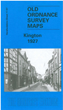
Herefordshire Sheet 17.07 Kington 1927 - published 2003. ISBN.978-1-84151-477-2 
This map of Kington shows the town in the top half of the map with the more rural area to the bottom. The north of the map features the railway line and station, Waterloo Bridge, Gravel Hill, St Mary's Church, Lady Hawkins Grammar School and Victoria Cottage Hospital.
The south of the map includes the Poor Law Institution, Penrhos Wood and Mortuary Chapel and Cemetery. On the reverse of the map is a list of private residents and a commercial directory.
Follow this link for a complete list of our Herefordshire maps.
You can order maps direct from our On-line Mapshop.
For other information and prices, and other areas, go to The Index Page.
Maps in the Godfrey Edition are taken from the 25 inch to the mile map and reduced to about 15 inches to the mile.
For a full list of maps for England, return to the England page.
The Godfrey Edition / sales@alangodfreymaps.co.uk / 20 January 2018