Old Ordnance Survey Maps of Herefordshire

  • These detailed maps normally cover an area of about one and a half miles by one mile. Each map includes an introduction.
  • They are available through our On-line Mapshop

  • Here are the details of maps for Leominster:

  • Herefordshire Sheet 12.15 Leominster 1927 - published 2002. ISBN.978-1-84151-464-2

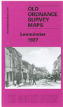
    This detailed map of Leominster gives full coverage of the town stretching from Ginhall westward to Eaton Hill eastward, with Bridge Street, Broad Street and South Street running north to south through the centre of the map. Features include Priory Church of St Peter & St Paul, Cattle Market, Cider Works, St Ethelberts RC Church, Station, Leominster Junction, Ridgemoor Bridge and Kenwater Bridge. On the reverse we have a list of private residents and a railway timetable for Worcester-Bromyard-Leominster line.


  • Follow this link for a complete list of our Herefordshire maps.
  • You can order maps direct from our On-line Mapshop. For other information and prices, and other areas, go to The Index Page.
  • Maps in the Godfrey Edition are taken from the 25 inch to the mile map and reduced to about 15 inches to the mile. For a full list of maps for England, return to the England page.
    The Godfrey Edition / sales@alangodfreymaps.co.uk / 20 January 2018