
 Here are the details of maps for Long Ashton:

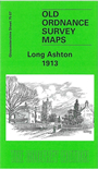
This detailed map covers the village of Long Ashton, SW of Bristol. Features in the village include All Saints church, Abbot's Barn, Angel Inn, Lower Court Farm, while to the south is the hamlet of Yanley. The map is surprisingly rural, the other major feature being South Liberty Colliery with GWR railway. On the reverse we include a directory of Long Ashton.
The map links up with sheets 75.03 Long Ashton to the north, 75.08 Bedminster Down to the east.
Maps in the Godfrey Edition are taken from the 25 inch to the mile map and reduced to about 15 inches to the mile. For a full list of maps for England, return to the England page.
Alan Godfrey Maps, Prospect Business Park, Leadgate, Consett, Co Durham, DH8 7PW / sales@alangodfreymaps.co.uk / 28 October 2016