
 Here are the details of maps for Bristol Eastville:

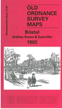
This detailed map covers the Eastville and Ashley Down areas on the north side of Bristol. Coverage stretches from Montpelier station eastward to Greenbank Cemtery, and northward to Dongola Avenue. A small portion of Stapleton, with Holy Trinity church and Colston's School is in the NE corner. Other features include Workhouse, football ground, Stapleton Gas Works, Midland Brick Works, stretch of Midland Railway Clifton Extension, stretch of GWR railway with Ashleyhill station, St Werburgh's church, New Orphan Houses, County cricket ground, St Andrew's Park, Ashleyhill Junction, Mina Road Park etc. On the reverse we include a directory for Stapleton and street directory entries for Ashley Down Road, Ashley Hill, Cobourg Road, Chesterfield Road, Eastville, Kensington Avenue, Robertson Road.
The map links up with sheets 72.05 Horfield to the north, 71.12 Redland to the west, 72.10 Fishponds to the east and 72.13 Bristol NE to the south.
Maps in the Godfrey Edition are taken from the 25 inch to the mile map and reduced to about 15 inches to the mile. For a full list of maps for England, return to the England page.
Alan Godfrey Maps, Prospect Business Park, Leadgate, Consett, Co Durham, DH8 7PW / sales@alangodfreymaps.co.uk / 28 October 2016