
 Here are the details of maps for Bridgend:

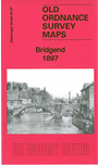
This detailed map covers the town of Bridgend and the area to the west. Coverage extends from Bridgend station westward to Broadland Fach.
Features include railway with station, Ogmore River, St Mary's church, Oldcastle area, Brewery, Newcastle area, Cefn-glas House, Bridgend & Cowbridge Workhouse, town centre with individual buildings neatly shown, St Illtyd's church, bridges, Tannery, schools, Ystrad Fawr etc.
On the reverse we includea list of private residents and churches from a 1906 directory.