
 Here are the details of maps for Porthcawl:

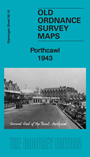
This detailed map gives excellent coverage of Porthcawl, which was developed as coal-shipping port in the mid 19th century and, when this failed, grew into a major seaside resort. In 1943 it was busy with American and British soldiers, many of them billeted here as they prepared for the Normandy landings.
Features on the map include town centre with individual buildings neatlyn shown, railway with station, Harbour, Esplanade Hotel, Sea Bank Hotel, Grand Pavilion, cinemas, All Saints Church, Congregational Church, railway sidings and layout, Coney Beach Amusement Park, Porthcawl Sands, Rhych Point, Newton Burrows. Part of Newton village is in the top right corner.