Old Ordnance Survey Maps of the City of Dundee

  • These detailed maps normally cover an area of about one and a half miles by one mile. Each map includes an introduction.
  • They are available through our On-line Mapshop

  • Here are the details of maps for Broughty Ferry:

  • Forfarshire Sheet 54.08 Broughty Ferry 1901 - published 1992; intro by Linda McGill. ISBN.978-0-85054-497-8

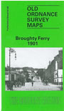
    This detailed map gives good coverage of Broughty Ferry, just east of Dundee. Coverage runs from West Queen Street eastward to Barnhill station, and from Fintry Place southward to Broughty Castle.

    Features include railway with Broughty Ferry and Barnhill stations, Pier Branch with station, Pier, Broughty Castle, King Street area, Brook Street area, Camperdown Nursery, St Stephen's church, St Luke's UF church, Balgillo House, Fort Hill, Castle Green, Reres Hill, Castleroy, Camp Hill, Dalhousie Nursery, The Bughties, etc. On the reverse we include extracts from a contemporary trade directory.


  • Follow this link for a complete list of our Angus & Dundee maps.
  • You can order maps direct from our On-line Mapshop. For other information and prices, and other areas, go to The Index Page.
  • Maps in the Godfrey Edition are taken from the 25 inch to the mile map and reduced to about 15 inches to the mile. For a full list of maps for Scotland, return to the Scotland page.
    The Godfrey Edition / sales@alangodfreymaps.co.uk / 19 Nov 2016