
 Here are the details of maps for Frinton and Walton le Naze:

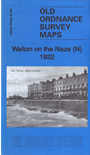
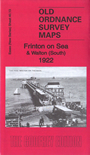
These two maps give good coverage of the two Essex seaside towns of Walton on the Naze and Frinton on Sea. Both maps are double-sided to give maximum coverage.
The Walton North map covers the northern part of Walton. Features here include All Saints church, High Street, Old Pier Street, Saville Street, Old Mill Pond, Walton Ashes. The backing map (sheet 40.10) covers East Terrace, Naze Park, convalescent homes, Coastguard Station, Iron Foundry.
The Frinton and Walton South map covers the southern part of Walton, including the station and the pier, with its tramway. The map then shows the northern part of Frinton, including the station, Esplanade, Hadleigh Road etc. The backing map (sheet 50.01) takes coverage southward to include The Greensward, Grand Hotel, St Mary's church, Connaught Avenue, Free Church, Queen's Hotel.
Between them the two maps give excellent coverage of the pair of towns.
Maps in the Godfrey Edition are taken from the 25 inch to the mile map and reduced to about 15 inches to the mile. For a full list of maps for England, return to the England page.
Alan Godfrey Maps, Prospect Business Park, Leadgate, Consett, Co Durham, DH8 7PW / sales@alangodfreymaps.co.uk / 6 November 2018