 Here are the details of maps for Edinburgh (Castle):

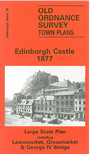
This wonderfully detailed map covers the area around and to the east of Edinburgh Castle, with coverage stretching from Spittall Street eastward to Lothian Street, and from the National Galleries southward to Bristo Place.
Features include George Heriots Hospital, Corn Exchange, Museum of Science and Art, Free Church Assembly Hall, Castle, Assembly Hall, National Galleries, St Giles church, County Hall, Watt Institution, Bank of Scotland, Police Chambers, Union Bank, New Greyfriars church, Signet Hall and for most of these even interior layouts are given. Other features include Grass Market, Lawn Market, George IV Bridge, The Mount, cattle market etc.
On the reverse we include the 1894 town plan, sheet 3.7.20, which covers the Grassmarket, St Giles church and Lawnmarket area.
The map links up sheet 29 Edinburgh New Town to the north, 34 Western New Townto the west, 36 South Bridge to the east and 39 Lauriston to the south.