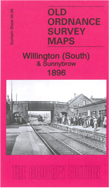
Durham 34.06 Willington (South) & Sunnybrow 1896 - published 2021; intro by Alan Godfrey. ISBN.978-1-78721-432-3 
This detailed map covers the southern part of Willington, and Sunnybrow.
Features include much of Willington town centre, including St Stephen's church, Willington Hall, railway station, Willington Old Hall, Willington or Sunnybrow Colliery,
Sunnybrow village, St John's church Sunnybrow, Bowden Close Railway, Burn Farm, Seldom Seen, Jubilee Bridge, part of Todd Hill, etc.
The map links up with sheet 34.02 Willington North to the north.
Follow this link for a complete list of our Durham maps.
You can order maps direct from our On-line Mapshop.
For other information and prices, and other areas, go to The Index Page.
Maps in the Godfrey Edition are taken from the 25 inch to the mile map and reduced to about 15 inches to the mile.
For a full list of maps for England, return to the England page.
Alan Godfrey Maps, Prospect Business Park, Leadgate, Consett, Co Durham, DH8 7PW / sales@alangodfreymaps.co.uk / 4 June 2021
 Here are the details of maps for Willington (South):