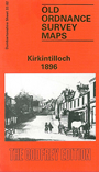
 Here are the details of maps for Kirkintilloch:

This detailed map of Kirkintilloch, a small town just NE of Glasgow, is double-sided for maximum coverage. The main map covers the area from Cowgate northward to Kelvin Valley West Junction and Inchbreck, and eastward to Bridgend Farm and Meiklehill House. Features include Meiklehill Colliery Pit 5, Hillhead, Waverley Park, remains of the Antonine Wall, Langmuir Rows, Forth & Clyde Canal, Kelvinside Factory, Lion Foundry, station, High Street. On the reverse we include a section of adjacent sheet 33.06, extending coverage south and this includes Holmfield Mill, Old Aisle Burial Ground of St Ninians church, Townhead, East Greens, South Bank Iron Works, canal basins, Basin Iron Foundry, Wester Mains House.
The map links up with Lanarkshire sheet 2.09 Lenzie to the south.