This is one of three maps being published for Duisburg, as companion to the Ruhrgebiet maps. It is taken from the British War Office plans, published in 1945, prior to the Allied occupation of the area, and is especially good at showing industry, collieries and transport. The maps are neatly folded
and each includes a specially written introduction to the area. Maps can be purchased on our
On-line Mapshop.
 Here are the details of our map of the south Duisburg area:
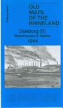
- 3 Duisburg (S): Rheinhausen & Wedau 1944 - published 2011. Introduction in English by Alan Godfrey; German summary by Heike Hamilton

This colour-printed map covers the southern part of Duisburg, including Wanheim, Angerhausen, Buxchholz, Hochfeld, Wanheimerort, Wedau. On the left bank of the Rhine we have Rheinhausen with bits vast Krupp steelworks; also Friemersheim, Bergheim, Atrop, Schwarzenberg, Hochemmerich.
The area is fascinating for its various industries and railways, on the edge of the Wedau woods. Of especial interest to many British readers are the barracks at Buchholz, built as a German anti-aircraft barracks, but later taken over as Glamorgan Barracks. We also include an index naming many of the factories and other large buildings.
You can order maps direct from our On-line Mapshop.
For a full list of maps for Germany and prices go to the Germany Page. For other information, see the Index Page.
Alan Godfrey Maps
Prospect Business Park
Leadgate, Consett, DH8 7PW
England
Tel. (01207) 583388 or Fax (01207) 583399
Return to Index
The Godfrey Edition / For orders and general enquiries: godfreyedition@btinternet.com / revised 26 July 2011