
 Here are the details of maps for Dun Laoghaire:

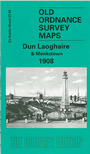
This very detailed map gives good coverage of Dun Laoghaire - formerly known as Kingstown - and Monkstown, with coverage stretching from Newtown Avenue eastward to the East Pier, and from the coast southward to Vesey Place.
Features include Kingstown & Bray railway line with Seapoint station, Salthill station, Kingstown or Dun Laoghaire station, Carlisle Pier, West Pier, part of East Pier, Traders Wharf, Victoria Wharf, Town Hall, Pavilion Gardens, tramways, St Mary's Convent, De Vesci Gardens, Old Harbour, St Patrick's RC church, St Michael's RC church, Stradbrook, Rockfield House, Dunardagh, tramway depot, Blackrock Lodge, Seapoint Templehill, Belgrave Square, St Patrick's Refuge, hotels, Mariners church, Royal Irish Yacht Club, Montpelier etc. Most of adjacent sheet 23.07 is included as an inset to give good coverage.