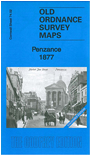
Cornwall Sheet 74.02 Penzance 1877 - published 2012; intro by Tony Clifford. ISBN.978-1-84784-709-6 

This detailed map gives excellent coverage of the town of Penzance; part of adjacent sheet 74.06 is also included as an inset.
Features include railway with station, St Mary's church, Custom House, Marine Terrace, Harbour, Chyandour, Trevarrack, Lescudjack Hill, town centre with individual buildings neatly shown,
Treneere Mill, The Public Buildings, Market House, St Paul's church, Market Jew Street, Lannoweth House, Morrab House etc. The map is in colour,
taken from the beautiful handcoloured 1st Edition OS map.
Follow this link for a list of our maps for Cornwall or here for a general list for the South West.
You can order maps direct from our On-line Mapshop.
For other information and prices, and other areas, go to The Index Page.
Maps in the Godfrey Edition are taken from the 25 inch to the mile map and reduced to about 15 inches to the mile.
For a full list of maps for England, return to the England page.
Alan Godfrey Maps, Prospect Business Park, Leadgate, Consett, Co Durham, DH8 7PW / sales@alangodfreymaps.co.uk / 13 January 2018

 Here are the details of maps for Penzance: