Cornwall Sheet 39.04 Newquay (East) 1933 - published 2014; intro by Tony Clifford. ISBN.978-1-84784-751-5 
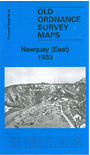
This detailed map is one of two we have published for Newquay. This covers the eastern part of the town, with coverage extending from Tolcarne Point and the station eastward to part of Treviglass.
Features include railway with station and engine shed, Tolcarne Sands, Barrowfields, Lusty Glaze, Trenance, Narrow Cliff, Porth Veor, isolation hospital, Tretherras,
Gusti Veor etc. Extracts from a 1910 directory are included on the reverse.
The map links up with Sheet 39.03 Newquay West to the west.
Follow this link for a list of our maps for Cornwall or here for a general list for the South West.
You can order maps direct from our On-line Mapshop.
For other information and prices, and other areas, go to The Index Page.
Maps in the Godfrey Edition are taken from the 25 inch to the mile map and reduced to about 15 inches to the mile.
For a full list of maps for England, return to the England page.
Alan Godfrey Maps, Prospect Business Park, Leadgate, Consett, Co Durham, DH8 7PW / sales@alangodfreymaps.co.uk / 13 January 2018

 Here are the details of maps for Newquay (East):