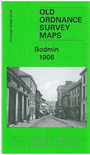
Cornwall Sheet 34.02 Bodmin 1906 - published 2009; intro by Richard Oliver. ISBN.978-1-84784-344-9 
This detailed map covers most of Bodmin, once the county town of Cornwall. Coverage stretches from the Asylum eastward to Love Lane, including all the town centre.
Features include Bodmin & Wadebridge Railway with terminus, St Petrock's church, Fore Street area, Bore Street area, County Lunatic Asylum, Bodmin Workhouse,
part of Bodiniel (in top left corner), etc. On the reverse we include a list of private residents from a 1910 directory.
Follow this link for a list of our maps for Cornwall or here for a general list for the South West.
You can order maps direct from our On-line Mapshop.
For other information and prices, and other areas, go to The Index Page.
Maps in the Godfrey Edition are taken from the 25 inch to the mile map and reduced to about 15 inches to the mile.
For a full list of maps for England, return to the England page.
Alan Godfrey Maps, Prospect Business Park, Leadgate, Consett, Co Durham, DH8 7PW / sales@alangodfreymaps.co.uk / 13 January 2018

 Here are the details of maps for Bodmin: