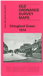
Essex (New Series) 69.09 Chingford Green 1914 - published 1998; intro by Alan Godfrey. ISBN.978-0-85054-984-3 
This detailed map is centred on Chingford Green and covers an area stretching from Low Street eastward to Chingford station and Gordon Road; and from
Pole Hill southward to Endlebury Road and Simmons Lane. Features include The Green, Chingford Goods Yard (former station), Station Road, Park Hill, Kingshead Hill,
Mansfield Hill, Warren Road, St Peter & St Paul's church. On the reverse is a directory for Chingford in 1895.
The map links up with London Sheets 2 Picketts Lock to the west, Essex Sheet 69.10 Buckhurst Hill to the east and
69.13 Chingford Hatch to the south.
Follow this link for a list of our maps for the London Borough of Waltham Forest, or here for a complete list of our 'Essex-in-London' maps .
You can order maps direct from our On-line Mapshop.
For other information and prices, and other areas, go to The Index Page.
Maps in the Godfrey Edition are taken from the 25 inch to the mile map and reduced to about 15 inches to the mile.
For a full list of maps for England, return to the England page.
Alan Godfrey Maps, Prospect Business Park, Leadgate, Consett, Co Durham, DH8 7PW / sales@alangodfreymaps.co.uk / 26 October 2017

 Here are the details of the map for Chingford: