Old Ordnance Survey Maps of Stockport

  • These detailed maps normally cover an area of about one and a half miles by one mile. Each map includes an introduction.
  • They are available through our On-line Mapshop

  • Here are the details of maps for Cheadle Hulme (North):

  • Cheshire Sheet 19.06 Cheadle Hulme (North) 1907 - published 2014; intro by Chris Makepeace. ISBN.978-1-84784-820-8

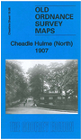
    This detailed map covers the northern part of Cheadle Hulme, from the railway station northward to Moseley Hall. Features include LNWR railway with Cheadle Hulme station, Langworthy Brick Works, Ladybridge Farm, Adswood Farm, Mayfield Grove, Moseley Grange, Orrishmere Farm, Demmings Dye & Bleach Works, Bruntwood Hall, Moseley Hall, Cheadle Golf Course, Micker Brook, Cringle House etc.

    We include an 1898 directory of Cheadle Hulme on the reverse.

    The map links up with Cheshire sheet 19.02 Cheadle to the north, 19.07 Bramhall Grange to the east, 19.10 Cheadle Hulme (S) to the south.


  • Follow this link for a complete list of our Stockport area maps.
  • You can order maps direct from our On-line Mapshop. For other information and prices, and other areas, go to The Index Page.
  • Maps in the Godfrey Edition are taken from the 25 inch to the mile map and reduced to about 15 inches to the mile. For a full list of maps for the North West, return to the North West page.
    The Godfrey Edition / sales@alangodfreymaps.co.uk / 27 Janury 2018