Old Ordnance Survey Maps of Trafford MBC

  • These detailed maps normally cover an area of about one and a half miles by one mile. Each map includes an introduction.
  • They are available through our On-line Mapshop

  • Here are the details of maps for Northenden:

  • Cheshire Sheet 9.16 Northenden 1908 - published 2003; intro by Chris Makepeace. ISBN.978-1-84151-535-9

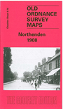
    This detailed map covers the the western part of Northenden, from St Wilfrid's church (which is split by the margin) westward to Button Lane. Features include Wythenshawe Hall, Rack House, Yewtree Lane, Kenworthy, Kenworthy House, Moorend, Northenden Mill, Lawton Moor etc. On the reverse we include a selection of street directory entries, including Albert Road, Beech Avenue, Church Road, Kenworthy Lane, Palatine Road, Princess Road, Royle Green Road, Wythenshawe Road.

    The map links up with Cheshire Sheet 9.15 Sale Brooklands to the west, 19.01 Gatley to the south. It also partly links up with Lancashire sheet 111.10 Didsbury Palatine Road.


  • Follow this link for a complete list of our Trafford or manchester maps..
  • You can order maps direct from our On-line Mapshop. For other information and prices, and other areas, go to The Index Page.
  • Maps in the Godfrey Edition are taken from the 25 inch to the mile map and reduced to about 15 inches to the mile. For a full list of maps for the North West, return to the North West page.
    The Godfrey Edition / sales@alangodfreymaps.co.uk / 5 February 2018