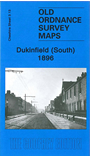
 Here are the details of maps for Dukinfield (S):

This detailed map covers the southern part of Dukinfield, and northern fringe of Hyde. Coverage stretches from Pickford Lane southward to Bennett Street, and from Cheetham Hill Road westward to the River Tame. Please note that the small area of Lancashire west of the Tame is left blank.
Features include Newton Wood area, Peak Forest Canal, Dukinfield Hall, Great Central Railway, Hyde Junction station, Bradleyhurst Farm, Barnmeadow Dyewood Mills, Dukinfield Collieries, Dewsnap Pit, Astley Deep Pit, Hyde Junction Iron Works, Johnsonbrook Mill, Victoria Colliery, St Luke's church, St Matthew's Mission Church, Plain Pit, Albert Mill etc. On the reverse we include a list of private residents from an 1896 directory.
The map links up with Cheshire sheet 3.09 Ashton & Dukinfield to the north and 11.01 Hyde to the south; also with the Lancashire maps of Guide Bridge and Denton.