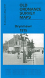
 Brecknockshire Sheet 47.07 Brynmawr 1915 - published 1998; intro by Janet Davies. ISBN.978-0-85054-960-7
This detailed map covers the town of Brynmawr, with coverage extending southward to Winchestown and the northern part of Nantyglo. It is packed with detail, including several railway lines while the SE quarter is littered with old mine workings. Features on the map include Brynmawr town, with Market Square, Newtown, Twyn-Cynnordy, Town Hall, Market Hall, St Mary's RC chapel, boot factory, other chapels, Clydachbridge, banks, football ground etc. The main LNWR & GWR Joint Railway is shown with station, a section of the Brynmawr & Blaenavon branch, mineral lines; also Twyn Blaen-nant, Twyn-blaen-nant, Mynydd Rheinallt, Blean-nant Colliery, Nantyglo Slope Colliery, Cwm Crachen, Twyn-y-deryn, Cokeyard Colliery (disused), Lion Tin Plate Works, Llyn Colliery, reservoir, etc. On the reverse we include a directory of Brynmawr, plus a railway timetable for the Brynmawr-Newport line in 1906. This map also includes a portion of Monmouthshire (sheet 11.07)
The map links up with Monmouthshire sheet 11.06 Beaufort to the west.