
 Brecknockshire Sheet 41.08 Crickhowell & Llangattock 1903 - published 2008; intro by Derrick Pratt. ISBN.978-1-84784-132-2
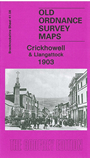
This detailed map covers the small town of Crickhowell, plus the village of Llangattock across the River Usk. Features include St Edmund's church, brewery, Alisby's Castle, Crickhowell Bridge, The Green, High Street, Porth Mawr, Glan-yr-afon etc. Features in Llangattock include St Cattwg's church, Cwrt, Llangattwg Park, Legar, and coverage extends to Dan-y-Park. On the reverse we include extracts from a 1906 directory listing commercial names and private residents.