
Old Ordnance Survey Maps of Northumberland
These detailed maps normally cover an area of about one and a half miles by one mile. Each map includes an introduction.
They are available through our On-line Mapshop
 Here are the details of maps for Berwick on Tweed:
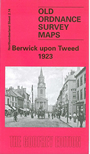
Northumberland Sheet 2.14 Berwick upon Tweed 1923 - published 2001; intro by Alan Godfrey. ISBN.978-1-84151-294-5
Our detailed map covers the heart of this historic town, including Berwick Bridge, the important railway station and its engine shed,
Magdalen Fields and the Bastions, the town centre etc. We also include extracts from a contemporary directory.
Follow this link for a complete list of our Northumberland maps.
You can order maps direct from our On-line Mapshop.
For other information and prices, and other areas, go to The Index Page.
Maps in the Godfrey Edition are taken from the 25 inch to the mile map and reduced to about 15 inches to the mile.
For a full list of maps for the North East, return to the North East page.
The Godfrey Edition / sales@alangodfreymaps.co.uk / 15 January 2018