 Here are the details of maps for Troon:

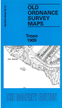
This detailed map covers the Ayrshire coastal town of Troon and is double-sided for maximum coverage. The main map covers the northern part of the town, with coverage from Academy Street northward to the Barassie Carriage & Wagon Works. Sheet 21.16 (to the west) is included as an inset. Features include the Harbour with railway lines, docks, even mooring posts; Inner Harbour, Outer Harbour, Wet Dock, Graving Dock, Ailsa Shipbuilding Yard, West Pier, GSWR Troon Loop Line with Troon station, Ayr & Stranraer Branch with Goods station, Portland Arms Hotel, St Meddans House, Wallacefield, wagon works etc. On the reverse we include a good part of adjacent sheet 27.01 extending coverage to the south, including South Sands, Troon Golf Club, Ayrshire Polo Ground, Marine Hotel, etc.